Since departing Lima the Adventure has traveled and visited much. The first stop was Paracas. I stayed at a nice little beach town there. I took a boat tour of the Ballestas Islands a short distance off the coast, these islands are an important sanctuary for marine fauna like the guanay guano bird, the blue-footed booby and the tendril. Other notable species include Humboldt Penguins and two varieties of seals (fur seals and sea lions), amongst other mammals.


Scallop Fisherman


After leaving Paracas I rode to Nazca where I took an airplane tour of the Nazca Lines. The Nazca Lines are a series of ancient geoglyphs located in the Nazca Desert in southern Peru. They were designated as a UNESCO World Heritage Site in 1994. The high, arid plateau stretches more than 80 km (50 mi) between the towns of Nazca and Palpa on the Pampas de Jumana about 400 km south of Lima. Although some local geoglyphs resemble Paracas motifs, scholars believe the Nazca Lines were created by the Nazca culture between 400 and 650 AD. The hundreds of individual figures range in complexity from simple lines to stylized hummingbirds, spiders, monkeys, fish, sharks, killer whales, and lizards.


The Hummingbird


Photo of Nazca.

From Nazca I rode two days to Cusco. During this ride I crossed some high passes in the Andes Mountains and was between 4000-4600 meters (13,000-15,000 feet) for about four hours. I have never been at that altitude for that length of time and both the bike and I handled it with no problem.
Two French cyclist I met between Nazca and Cusco.

A heard of LLama I met between Nazca and Cusco.


I arrived in Cusco on Sunday afternoon of the 21st and found a hotel within an hour. I spent Monday acclimating to the altitude of Cusco (3600m-12,00ft) and getting my bearings around the inner city. By mid-afternoon I had gotten used to walking up and down the city and was feeling much better.
On Tuesday I took a tour of the Sacred Valley. The tour was 12 hours and was very informative and interesting. Some photos of that tour.
These were Incan tombs that were robbed shortly after the Spanish conquest.


Here is a photo of our tour guide of the Sacred Valley, Valmier.


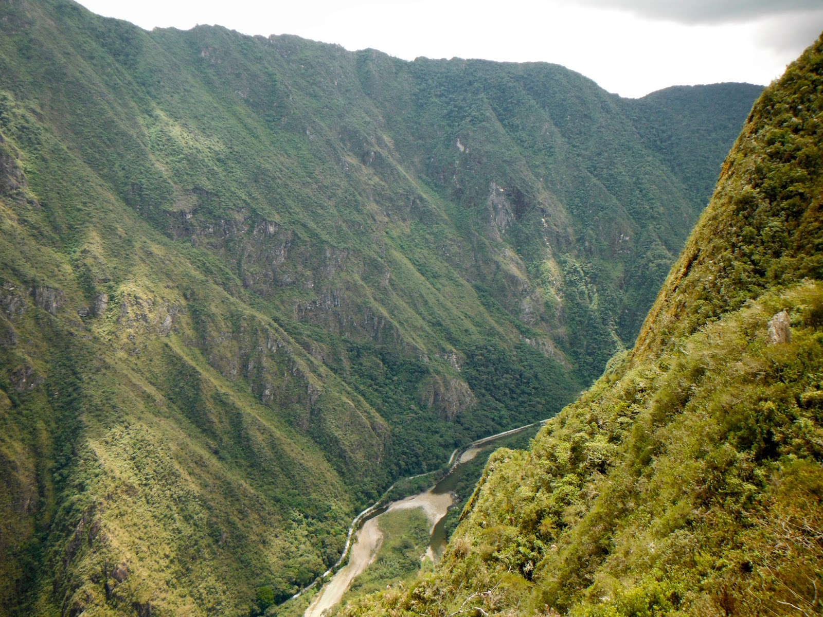
Yesterday I toured Machu Picchu. I departed Cusco at 4am and returned at 10:30pm...it was a full day.
Machu Picchu is a 15th-century Inca site located 2,430 meteres (7,970 ft) above sea level. It is situated on a mountain ridge above the Sacred Valley which is 80 kilometres (50 mi) northwest of Cusco and through which the Urubamba River flows. Most archaeologists believe that Machu Picchu was built as an estate for the Inca emperor Pachacuti (1438–1472). Often mistakenly referred to as the "Lost City of the Incas", it is perhaps the most familiar icon of Inca civilization.
The Incas built the estate around 1450, but abandoned it a century later at the time of the Spanish Conquest. Although known locally, it was unknown to the outside world before being brought to international attention in 1911 by the American historian Hiram Bingham. Since then, Machu Picchu has become an important tourist attraction. Most of the outlying buildings have been reconstructed in order to give tourists a better idea of what the structures originally looked like. By 1976, thirty percent of Machu Picchu had been restored. The restoration work continues to this day.


I saw my first chiuchila.


This stone is a compass.


These two photos are of the sundial at Machu Picchu. It is also a compass that shows magnetic north and true north.


Scallop Fisherman
After leaving Paracas I rode to Nazca where I took an airplane tour of the Nazca Lines. The Nazca Lines are a series of ancient geoglyphs located in the Nazca Desert in southern Peru. They were designated as a UNESCO World Heritage Site in 1994. The high, arid plateau stretches more than 80 km (50 mi) between the towns of Nazca and Palpa on the Pampas de Jumana about 400 km south of Lima. Although some local geoglyphs resemble Paracas motifs, scholars believe the Nazca Lines were created by the Nazca culture between 400 and 650 AD. The hundreds of individual figures range in complexity from simple lines to stylized hummingbirds, spiders, monkeys, fish, sharks, killer whales, and lizards.
The Hummingbird
Photo of Nazca.
From Nazca I rode two days to Cusco. During this ride I crossed some high passes in the Andes Mountains and was between 4000-4600 meters (13,000-15,000 feet) for about four hours. I have never been at that altitude for that length of time and both the bike and I handled it with no problem.
A heard of LLama I met between Nazca and Cusco.
I arrived in Cusco on Sunday afternoon of the 21st and found a hotel within an hour. I spent Monday acclimating to the altitude of Cusco (3600m-12,00ft) and getting my bearings around the inner city. By mid-afternoon I had gotten used to walking up and down the city and was feeling much better.
On Tuesday I took a tour of the Sacred Valley. The tour was 12 hours and was very informative and interesting. Some photos of that tour.
These were Incan tombs that were robbed shortly after the Spanish conquest.
Here is a photo of our tour guide of the Sacred Valley, Valmier.
Yesterday I toured Machu Picchu. I departed Cusco at 4am and returned at 10:30pm...it was a full day.
Machu Picchu is a 15th-century Inca site located 2,430 meteres (7,970 ft) above sea level. It is situated on a mountain ridge above the Sacred Valley which is 80 kilometres (50 mi) northwest of Cusco and through which the Urubamba River flows. Most archaeologists believe that Machu Picchu was built as an estate for the Inca emperor Pachacuti (1438–1472). Often mistakenly referred to as the "Lost City of the Incas", it is perhaps the most familiar icon of Inca civilization.
The Incas built the estate around 1450, but abandoned it a century later at the time of the Spanish Conquest. Although known locally, it was unknown to the outside world before being brought to international attention in 1911 by the American historian Hiram Bingham. Since then, Machu Picchu has become an important tourist attraction. Most of the outlying buildings have been reconstructed in order to give tourists a better idea of what the structures originally looked like. By 1976, thirty percent of Machu Picchu had been restored. The restoration work continues to this day.
I saw my first chiuchila.
This stone is a compass.
These two photos are of the sundial at Machu Picchu. It is also a compass that shows magnetic north and true north.